Mill Creek Nature Park Google Map
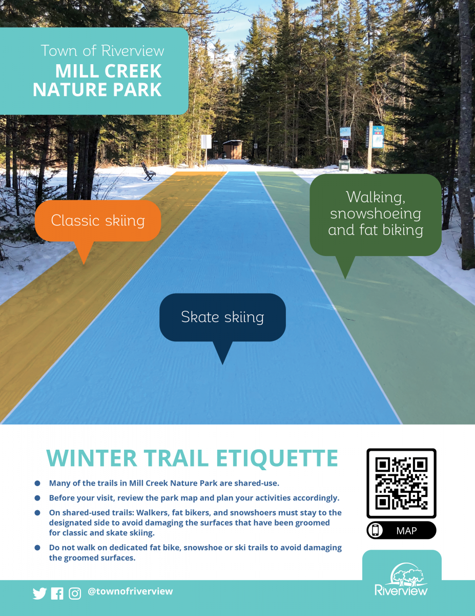
Winter Trail Etiquette:
The shared use trail sections are marked in white on the google map below. Let's all work together to ensure everyone can enjoy the park!
How to Use this Map:
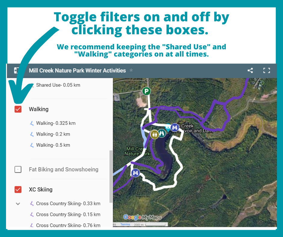
- Toggle the filters on/off to view the points of interest, shared use, walking, snowshoeing, fat biking and skiing trails by category.
- For best viewing of the map- we recommend keeping the points of interest, shared use and walking trail filters on at all times.
- All trail sections are labeled with the approximate total distance in kilometres. Click on the trail section for more information, including which trails are under development.
- Filters are available for people who ski and people who walk to view a few distance options for trip ideas.
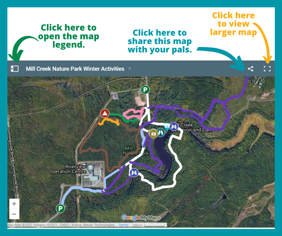
Map:
Caution- the GPS data collected is not 100% accurate. Be prepared, follow the blazes when you are on a trail and refer to a map- do not rely on a smart phone to navigate through the park. The purpose of this map is to help you plan your visit. Please check back often for updates.